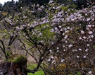
Landscape
Updated: 05 07 , 2013 19:41
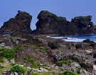
??Relief features: The island is formed by a great fault block trending north-northeast to the south-southwest, which is tilted toward the west. Its eastern margin, facing the Pacific Ocean and often lined with cliffs, marks the edge of the continental shelf. Its western section is on the slope of the shelf as is the Taiwan Strait, the shallower parts of which are only 320 feet below sea level. The coastline on the west is simple and straight, bordered with low sand dunes and lagoons. Deep-water ports are situated at Jilong, at the northern tip of the island, and at Gaoxiong, on the southwest coast. The crest of the Zhongyang Shanmai (Central Range) lies east of and parallels the island's axis. Scores of peaks rise above 10,000 feet, the highest being Yu Shan, (3,997 m). Around the mountainous area are numerous independent hills, with an average height of 5,000 feet. The relief on the east is very steep and that on the west quite gradual. The terrace tablelands and alluvial coastal plains in western Taiwan form the principal area of dense population; most of the majorities are located there. Drainage and soils: The rivers, all of which rise in the central range, are short and subject to extreme variations in flow. They are mostly shallow or dried up in the dry season, while there are floods in them on soon (rain-bearing wind) season. Lacking steady currents, most rivers are not navigable but are liable to cause floods, especially in the plains, necessitating extensive drainage systems.